C.M Office
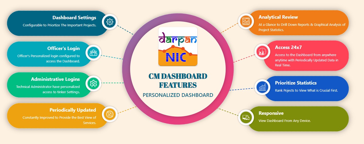
CM Dashboard
Dashboard for Analytical Review of Projects Across Nation
https://uk.cmdashboard.nic.in/
Official Website Of the Chief Minister Of Uttarakhand
https://cm.uk.gov.in
For donation in Chief Minister Relief Fund, Please click following link:
https://cmrf.uk.gov.in
You Will Get 100% Relief Under Section 80G Of The Income Tax Act.
Vidhan Sabha

Members of Parliament:
Rajya Sabha
Lok Sabha
Members of Legislative Assembly:
Members of Legislative Assembly
http://ukvidhansabha.uk.gov.in
Raj Bhawan
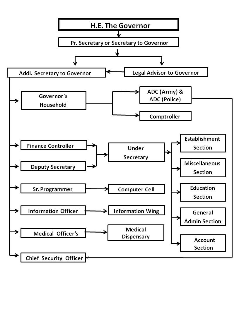
For Complete Profile, click on below Link:
About Uttarakhand
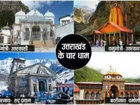
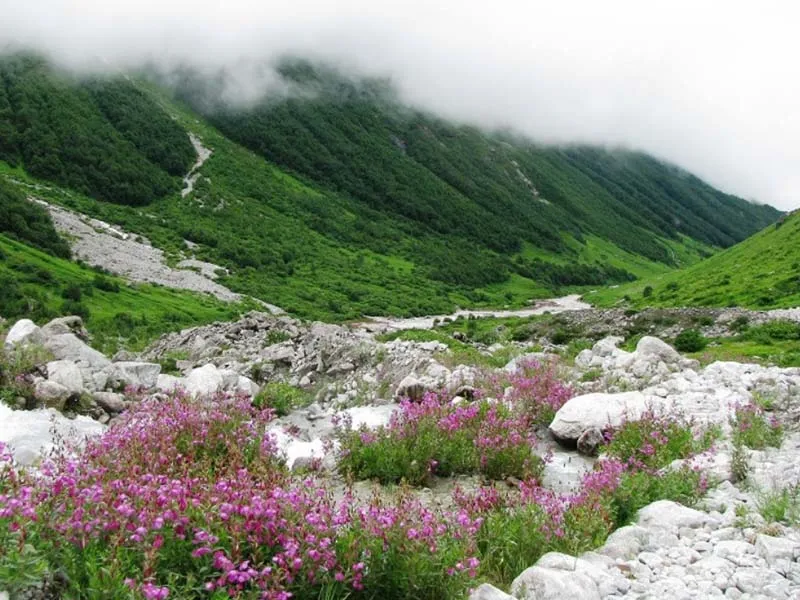
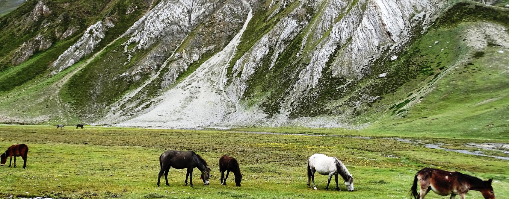
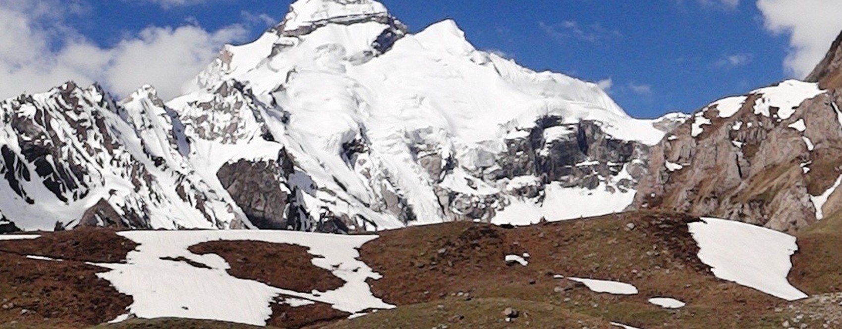
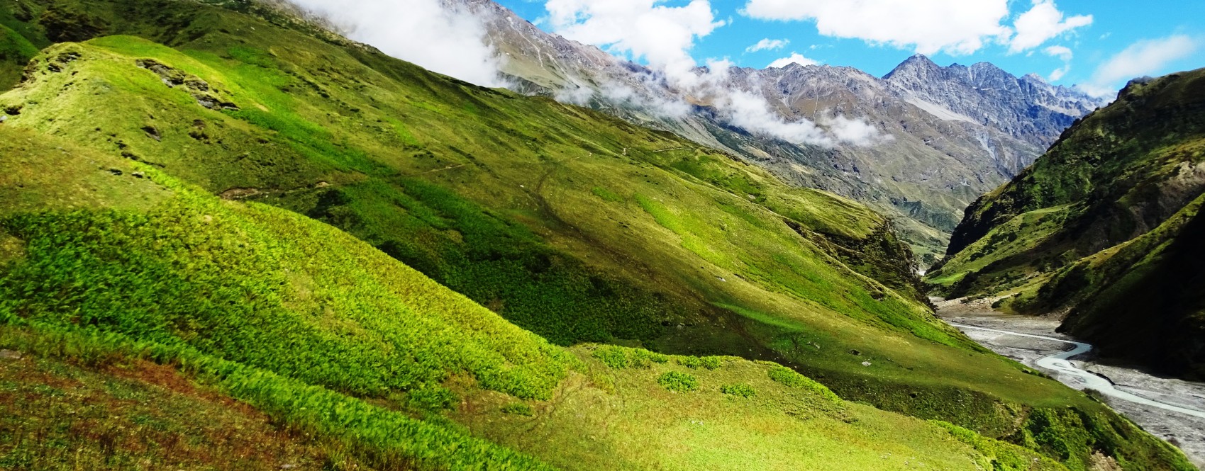
Uttarakhand was formed on the 9th November 2000 as the 27th State of India, when it was carved out of northern Uttar Pradesh. Located at the foothills of the Himalayan mountain ranges, it is largely a hilly State, having international boundaries with China (Tibet) in the north and Nepal in the east. On its north-west lies Himachal Pradesh, while on the south is Uttar Pradesh. It is rich in natural resources especially water and forests with many glaciers, rivers, dense forests and snow-clad mountain peaks. Char-dhams, the four most sacred and revered Hindu temples of Badrinath,Kedarnath, Gangotri and Yamunotri are nestled in the mighty mountains.
.jpg "About")
Demography
Total Population:100.86 Million
Male Population:51.38
Female Population:49.48
Rural Population:70.37
Urban Population:30.50
Density of Population: 189 per sq.km.
Child Sex Ratio: 890 Females/'000 males
Literacy Rate:78.82
Male Literacy Rate: 87.40
Female Literacy Rate: 70.01

Uttarakhand state comprises of two Divisions. Composition of Districts under each Division is as below:
Garhwal Division
- Chamoli
- Dehradun
- Haridwar
- Pauri Garhwal
- Rudraprayag
- Tehri Garhwal
- Uttarakashi
Kumaon Division
- Almora
- Bageshwar
- Champawat
- Nainital
- Pithoragarh
- Udham Singh Nagar
 source from wiki
Total Districts: 13

Click on District Name to visit District website
Total Tehsils: 107
Almora - 11
Bageshwar - 06
Chamoli - 12
Champawat - 05
Dehradun - 06
Haridwar - 05
Nainital - 08
Pitthoragarh - 12
Rudraprayag- 04
Tehri Garhwal - 12
Udham Singh Nagar- 08
Uttarkashi- 06

Total Blocks: 95
Almora - 11
Bageshwar - 03
Chamoli - 09
Champawat - 04
Dehradun - 06
Haridwar - 06
Nainital - 08
Pauri Garhwal - 15
Pitthoragarh - 08
Rudraprayag- 03
Tehri Garhwal - 09
Udham Singh Nagar- 07
Uttarkashi- 06

Total Gram Panchayats:7950
Almora - 1162
Bageshwar - 416
Chamoli - 615
Champawat - 313
Dehradun - 460
Haridwar - 308
Nainital - 511
Pitthoragarh - 685
Rudraprayag - 339
Pauri Garhwal - 1212
Tehri Garhwal - 1038
Udham Singh Nagar - 391
Uttarkashi - 500

Total Villages: 16793
Almora - 2289
Bageshwar - 947
Chamoli - 1246
Champawat - 717
Dehradun - 748
Tehri Garhwal - 1862
Pauri Garhwal - 3473
Nainital - 1141
Udham Singh Nagar - 668
Haridwar - 612
Uttarkashi - 707
Pitthoragarh - 1675
Rudraprayag - 688

- Budget 2023-24
- Result 2023 - Uttarakhand Board of School Education
- Notification
- Land Acquistion- Preliminary Information
- Details of portfolios to Hon’ble CM/Ministers
- Corona(COVID19) Updates
- Guidelines for uploading accessible documents
- Uttarakhand State IT Policy 2016-2025
- Uttarakhand Film Policy-2015
- Uttarakhand Film Policy-2019
- Public Notice - Professional License and Fee Collection Bye-2016
- Public Notice - Property / Building Tax ByeLaws-2016